June 3, 2014
“The Drive” begins – Grand Junction to Windsor CO
June 3 – The day for the beginning of “The Drive” has arrived, inevivitably. Got up at 4:30 a.m., since I still hadn’t packed and wasn’t really ready. I kept thinking that I was bringing too much stuff.
Charlotte arrived at my house about 8:20 a.m., right on time. We got everything loaded up, with Ron’s good help. After a prayer, we drove out the driveway, down to the I-70 and headed East. Very familiar territory. The Colorado River is running very high, on the verge of flood stage. Driving through Glenwood Canyon, we noticed that the bike path was flooded and unsable in many places.
Stopped for a brief lunch/potty break at the summit of Vail Pass. Read the signage about the geology and history of this area. Mount of the Holy Cross, the 10th Mountain Division, the Eisenhower-Johnson Tunnels through the Continental Divide. (Those titles can be “googled” for more information.)
Since it was just early afternoon, there wasn’t really much traffic in the Denver area,. Headed up the I-25 to Longmont, where we met up with our son, Justin, and our granddog Selah. We looked around at the Sandstone Ranch Regional Park, which was flooded last year in September. Everything is looking goodnow. It’s a real oasis.
We are staying in Windsor, a town between Fort Collins and Greeley. We are staying with my best friend from high school, Janie Johnson Shofner. She has a lovely home, decorated with quilts she has made. Janie has her two granddaughters with her, spending the night. Marley (7) and Gwen (5) are so cute. Marley has a twin brother Sutton, and the girls have an older brother, too. His name is Emerson (9).
Janie prepared a wonderful beef stew for us for dinner. Yummy! I will have to get the recipe. We had strawberry shortcake for dinner. The girls wanted to walk down the street to play at a neighborhood park. It was fun watching them play.
Shared a queen sized bed with Charlotte. The bed had a Log Cabin design quilt on it.
This is going to be all for today. Tomorrow will be a long day’s drive from here to Omaha NE.
Total miles driving today was 323 miles.
With love from “the road,”
Marie
June 4, 2014
“The Drive” – Windsor CO to Omaha NE
Got up at about 5:15 a.m., showered. Janie fixed us some scrambled egg and French toast. Little Gwen even got up early!
Got our gear loaded up. Fond farewells and hugs with Janie and Gwen. Left about 6:30 a.m. We wended our way over to Sterling via Hwy 14. Passed some sheep feedlots and prairie grass with blossoms that made it look like snow! We were on the southern edge of the Pawnee National Grasslands. The scenery was so beautiful and green!
Got to Sterling after a 100 mile drive East. Somehow I missed the signage for getting on the I-76 so we drove the parallel “old road” from Sterling to Julesburg and again was unsuccessful in getting on the I-76 but got on the I-80, which is what we wanted. At 9:50 a.m. we crossed the Nebraska state line. Then about 45 minutes later we crossed into the Central Time Zone (in effect losing an hour, so it became 11:42 a.m.)
The I-80 is somewhat familiar territory. Last drove on it 3 years ago on the way back from the “Plains to Lakes.” We also started our 2006 ride in Kearney, at the parking lot of the Great Platte River Road Archway. Charlotte and I toured it back in 2006. The I-80 parallels the Platte River, which is running at high water level as well.
After buying gas in Kearney (700 miles on 22.5 gallons) we continued Eastward on the I-80 towards Omaha. From a distance, we saw the state capitol building in Lincoln (it is one of 4 non traditional looking capitol buildings – the others are in Tallehassee Fl, Baton Rouge IL, and one of the Dakotas as I recall). Got in touch with George Lozier (Sandy’s husband) who gave us good directions to their home.
Arrived about 5:15 p.m. at their home in what used to be called Elkhorn; it’s now been assimilated into Omaha. Two stories, pool, hot tub, 3 car garage, lots of bedrooms, set on an acre. Sandy rode with us in 2006 for 3 days, and then did the whole 2007 ride “Rockies to Plains” from Grand Junction to Oklahoma City OK.
Sandy and George prepared sloppy joes, a great tossed salad, and a homemade blueberry pie for us for dinner! Yummy!
Drove 534 miles today.
With love from “the road,”
Marie
June 5, 2014
“The Drive” – Omaha NE to Kalamazoo MI
Sandy and George fixed us a nice breakfast of scrambled eggs, toast, juice, and turkey bacon. It really hit the spot!
Rolled out of their driveway (after fond farewell hugs) about 6:45 a.m. Traffic moved along at a good clip, on surface streets and onto the I-680. Weskirted around Omaha, crossed the Missouri River, into Iowa. The 680 merged into the I-80. Passed a sign for the “Wishnabotna River” (don’t you just love that name?). Signs for US Hwy 6 accompanied the I-80 signs; that fascinated me, since Hwy 6 passes through Grand Junction on North Avenue and through Palisade on its way to the tip of Cape Cod in Provincetown MA.
Stopped at one of the many rest stops in Iowa. Some are more primitive (parking only), no services. This one is in Adair County. The rest stop honored Henry Wallace, a former Vice President under FDR, who was also the Secretary of Agriculture and Commerce when he wasn’t VP. Wallace was a plant scientist who developed hybridized corn. He started the company that became Pioneer Hi-Bred. His motto was “Good farming, clear thinking, right living.” In 1999 the Des Moines Register called him “the most influential Iowan of the Century.”
Passed an exit sign for “Panora,” which is where Roberta Brink lives. Roberta is a friend from the HD community. So many interesting sounding names and places: (1) DeSoto Iowa was the birthplace of John Wayne (2) Silos and Smokestacks National Heritage Area (3) Belle Plaine and What Cheer (that is my favorite) Passed the World’s Largest Truck Stop (think that was in Iowa).
Crossed over the Mississippi River into Illinois, our third state of the day. Passed another interesting sign, indicating the birthplace of Ronald Reagan in Tampico IL. Stopped at one last rest stop along the I-80, the Great Sauk Trail Rest stop. It was named after an old Native American trail from the Mississippi River at Rock Island to the lower part of Lake Michigan. Stopped at a Sapp Brother’s gas station near Spring Valley IL which was recommended by our friends the Langlands, as being the best place to buy gas near Chicago. They were right! 87 octane was $3.53/gallon. Later we saw most stations with the price of $3.87/gallon.
Passed near Joliet and skirted around Chicago. Went on one short section of the I-80 where there was a $1.10 toll for about a 3 mile stretch before we got back on the free I-80. Crossed into our fourth state of the day, Indiana. Only about 45 miles of Indiana before finally crossing into Michigan, our fifth and last state of the day. Indiana had lots of large trees lining the Interstate, as did Michigan. Lots of cone zones/construction on the Interstates.
We had anticipated a 600 mile drive, but it ended up being 650 miles. Arrived safely at the home of Amy Mack in Kalamazoo. She will be riding the Michigan portion of “Bikin’ the Dixie Highway” with us. Lovely home with decks and a swimming pool, beautifully decorated, and welcoming. She had brats, deli cole slaw and potato salad waiting for us. Charlotte had pre-arranged for some of her former students to come to Amy’s home to visit.
We are now on Eastern Time, so we “lost” another hour. It’s 10:15 p.m. as I type, and we have to get up and be ready to drive the last leg up to Sault Sainte Marie. Charlotte called one of our other riders, Gary, and he is already in Sault Sainte Marie.
Good night, John Boy …. Goodnight, Elizabeth …… Good night Jim Bob, and goodnight to everyone else on the distribution list.
With love from “the road,” in Kalamazoo MI,
Marie
June 6, 2014
The last day of “The Drive” – Kalamazoo to Sault Sainte Marie MI
Up at 5:00 a.m. Charlotte had already been awake for 3 hours, after just 3 hours of sleep! Those of you who are on both of our distribution lists, I hope you appreciate all the time and effort Charlotte puts into her reports.
Amy fixed us a nice breakfast of scrambled eggs, fresh fruit, and toast. Yummy!
Kathy Lindner (one of our Michigan based riders) arrived at Amy’s about 6:20 a.m. with her bike and gear. First time Charlotte and I have met her face to face. We loaded up her gear, attached her bike on the rear bike rack, visited a little, and then left Amy’s home for the drive North on US 131 and the I-75.
Charlotte only got 3 hours of sleep last night, so she zonked out. Kathy didn’t get too much sleep last night, either. I just kept driving.
First major site was Grand Rapids MI. That was the first big city that we drove through the middle. It is the site of the Gerald Ford Presidential Library (he was from Grand Rapids). More about Grand Rapids on my Day 6 daily message. Had to laugh about the name of the baseball stadium there; it’s the Fifth Third Stadium (some of you may remember other references to this strange named bank from other years).
The road changed from controlled access to a two laned road (one in each direction). Passed through lots of smallish towns. Snowmobiling is very popular in Michigan. There were lots of signs with a snowmobile logo (yellow diamond with black silhouette). We crossed the 45th parallel, which is halfway between the equator and the North Pole. I recalled crossing it in Oregon during the 2001 “Border War on HD” ride with Charlotte and also Amanda Adams.
The highways are very tree lined. Lots of trees in Michigan. Finally got closer to Lake Michigan around Petoskey (again, more on Petroskey on Day 2's daily message).
Finally got to Mackinac City. Funny, both Mackinac and Mackinaw are pronounced the same here. We crossed a beautiful Suspension Bridge (cream colored with medium green) Toll was $4 for regular passenger cars/vans. Kethy woke up from one of her naps just as we started over the bridge. When we got to the other side, we were now on the I-75 and on the Upper Peninsula (abbreviated as the U.P.) inhabitants of the U.P. are called “Yoopers.” This word was just recently added to the dictionary.
87 octane rose in price from $3.53/gallon outside Chicago to $3.99/gallon now. Yikes!
We found the church pretty easily. We’re staying at the Calvary Baptist Church. When we got there, Gary and his friend Don were there to welcome us. They drove up from the Columbus OH area yesterday (Thursday).
After getting settled in the nursery room, Kathy, Charlotte and I headed into Sault Sainte Marie. The word “Sault” is from French, and means “rapids.” It is pronounced “Soo.” It is famous for the Locks which raise and lower ships. Lake Superior is 21 feet higher than Lake Huron over the distance of 63 miles). The Soo Locks consist of two canals andfour locks: Davis, Poe, MacArthur, and Sabin, which is closed. There is anticipation of building a larger state-of-the-art lock to assist in handling the larger vessels of the Great Lakes fleet. There is talk to repace the Sabin, but it is not funded by Congress as yet. The Saint Mary’s River forms the border betweenthe US and Canada. The Army Corps of Engineers (a brance of the US Army) runs the Locks.
I shopped a little for postcards after we toured the Visitor’s Center and climbed up on the large Observation Platforms. It was very interesting.
I had heard about a special Upper Peninsula creation called a Pastie (the “a” is pronounced with the short a sound, like “a” in “apple.”) They are so large that we determined that we should just buy one and split it three ways. Filling is meat (we got chicken), rutabaga, potato, onion, salt, and pepper inside a dough covering like a half-moon shaped pie crust. It’s shaped like an Italian calzone. We brought it back to the church to eat for dinner, along with a green salad.
Stopped at a supermarket for some lettuce, bananas, and bread, staples for our typical lunches.
Returned to the church, where we got our gear a bit more organized, since the ride starts tomorrow. Ate the Pastie and really liked it.
The weather was perfect today, just delightful.
Drove 348 miles today, for a total of 1954 miles in 4 days. Glad to be here in a place I’ve only heard about before. God has brought me to this place, to raise awareness and funds for Huntington’s Disease.
Tomorrow will start the day by day stories.
Keep us in your thoughts and prayers, and send an e-mail if you can find the time. Use bike4cure@gmail.com to get a message directly to me.
With love from the road, ready to start “Bikin’ the Dixie Highway” tomorrow.
With Love,
Marie
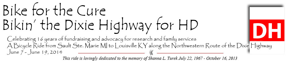
June 7, 2014
Bikin’ the Dixie Highway – Day 1 – Sault Sainte Marie to St. Ignace
Sault Saint Marie, or “The Soo” as the locals call it, translates from the French as “The Rapids of St. Mary.” It is the county seat of Chippewa County on the northeastern end of Michign’s Upper Peninsula, separated from its twin city of Sault Ste. Marie, Ontario Canada, by the St.Mary’s River.
Sault Ste Marie was already a place of Native American settlement 500 years ago. It became the first European settlement in the region that became the Midwestern United States, when, in 1668, Fathers Jacques Marquette and Claude Dablon founded a Catholic mission. It is the third-oldest European city west of the Appalachian Mountains in what is now the US, and the oldest permanent settlement in contemporary Michigan state. It was claimed by the French on June 4, 1671. It became the center of a trading route that extended from Montreal to the Sault, and from the Sault to the country north of Lake Superior. It wasn’t until 1817 that this former single settlement became American and Canadian communities, with the river as the border. These twin cities are joined by the International Bridge, which connects them. There are canals on both sides, with locks. The larger shipping traffic uses the American Soo Locks, the world’s busiest canal in terms of tonnage passing through, and the smaller recreational/tour boats use the Canadian Sault Ste Marie Canal. The largest ships (called “lakers”) are 1,000 feet long and 105 feet wide. These ships are too large to transit the Welland Canal that bypasses Niagara Falls, so they are land-locked. Foreign ships (called “salties”) are smaller.
We got up early as usual (4:00 ish). Everyone fixed his/her own breakfast, got the van loaded up. The Pastor came over to say good-bye, and he prayed with/for us four riders before we look off.
We are following the Mackinac Trail from “the Soo” (as locals call it) South to St. Ignace (pronounced St. “Ig-nus, like the women’s name “Agnes” but with a “short I sound,” not a “short a sound). This road is also referred to as the S 35 bike road, or “the old road.” I’m thinking it was the Dixie Highway back in the day. It pretty much parallels the I-75 but with maybe 1% of the traffic. I don’t think even 15 cars passed us when we were riding. It worked out well that Gary and Kathy rode together, the whole distance, and Charlotte and I “leap frogged” in our usual way. It was the farthest I’d ridden at one time this year, so I was pleased with the 18.75 miles. We used an excellent map provided courtesy of the Michigan Department of Transportation. What a blessing it was!
Gary, his van driver Don, and Kathy rode a little off the main road to Rudyard, where they had breakfast. Gary is known for his affinity for a “B2?(second breakfast) in local diners. There was a two mile “cone zone” on the Mackinac Trail, which is undergoing some upgrades in order to meet the current qualifications. A culvert under the I-75 needs to be repaired, and traffic will be re-routed onto the Mackinac Trail between the turn-off for Rudyard and the next interchange South. The Mackinac Trail needs to be upgraded to handle all that additional traffic.
The Mackinac Trail merged with/into the Business I-75 right near Castle Rock, a monolithic granite limestone stack with a fenced observation area on top. Continued South on the Business I-75 into downtown St. Ignace. Charlotte was riding the last leg. I spotted her visiting with someone doing weeding in front of the Chamber of Commerce building. I lead her in to the Catholic Church, St. Ignatius Loyola, which is on a hill! We are staying in the “Catholic Center” which houses the children’s Religious Education classrooms. Lots of room to spread out, and 2 couches in the room where Charlotte and I are staying.
We ate lunch, then went our separate ways. We were invited to attend the Catholic mass at 5:00 p.m. with the new Bishop. Afterwards, there is a potluck dinner (to which we were also invited.)
A bit about St. Ignace. It’s a quaint waterfront small town. Its history dates back more than 300 years and it’s full of Native American (Ojibwa, Huron, and Odawa), French and American history. It is the third oldest continuously inhabited city in the United States as well as the second-oldest city founded by Europeans in Michigan. It has always thrived because of its rich soil and active waterways enabling farming, travel, and trade. This city was established as a mission in the year 1671 by Father Jacques Marquette, and named after St. Ignatius of Loyola, the founder of the Jesuit order of Catholic priests. The Jesuits abandoned the mission in 1705. The Ojibwe were allies of the French in the Seven Years’ War. The English won that war, and in 1763 they took over this territory of the former “New France.” After the American Revolution, in 1783, the village became part of the new United States. It was incorporated as a village in 1882 and as a city in 1883. Railroads connecting St. Ignace to Detroit became a key area of industry for the area shipping out iron-ore and lumber down state. Commercial fishing thrived in the early 1900's and accommodations, docks, and businesses were established along the shoreline.
St. Ignace is at the northern end of the Mackinac Bridge. It is the gateway to Michigan’s Upper Peninsula and also provides ferry service to Mackinac Island.
Much of the tourism centes around Mackinac Island, with ferry boats tansporting people to the Island. There are no cars on the island, but there are horse drawn carriages and people ride bicycles as well. They are known for three scents: their fudge, lilacs, (and I toyed with the idea of taking a ferry over to smell their lilacs) and their fresh road apples. I had thought about taking a ferry boat over there and touring, but decided not to. Maybe another time.
One more bit of trivia. There are two spellings of Mackinac and Mackinaw. They are both pronounced the same (Mack-in-awe). The word with the “C” at the end is the French spelling, and the word with the “W” at the end is the English spelling.
Amy Mack will be joining us tomorrow after we drive across the Mackinac Bridge back to the Lower Peninsula. She will ride with us Sunday, June 8 – Friday, June 13. She is joining us a day late because of a previous commitment to attend the wedding of a co-worker.
Everyone but me attended the Mass with the new bishop. The potluck was very nice: roast beef or fried chicken, lots of different salads, rolls, green beans, lots of different desserts. Three men (perhaps 2 were priests) played the piano, accordian, and guitar and some people sang songs like “You are my Sunshine,” “Good Night, Irene,” “This Land is Your Land,” and about 10 more. The bishop went around “table hopping,” so we got to speak to him. Seemed like a nice man, fairly young to be a Bishop.
Our first day of riding went well, and we are looking forward to another “short” ride tomorrow on a bikepath that parallels US 31. Possible rain showers are predicted, so we shall see what develops …
With love from the road, in St. Ignace, MI,
Marie
PS:
Today’s mileage: 51 miles.
Charlotte rode 30,
Marie rode 19,
Gary and Kathy both rode 51.
1 penny in “Road Change.”